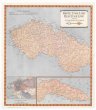
Geological Map of the Lake Superior land district in the state of Michigan
description
Barev. 59 x 91 cm, na listu 98 x 69 cm, složeno na 23 x 23 cm v kartonových deskách 24 x 24 cm Měřítko [ca 1:724 000] (090°19´23" z.d.--080°35´45" z.d./050°29´09" s.š.--042°49´29" s.š.)
- institution
- Mapová sbírka Přírodovědecké fakulty UK v Praze
- subcollection
- Mapová sbírka
- type
- Mapy
- alternate name
- Maps
- subject author
- Foster J. W.;Whitney, J. D.
- date of issue
- 1850-1855
- document publisher
- J. Ackerman
- language
- Angličtina
- origin
- USA, New York
- material
- Papír
- original owner
- Razítko: Státní sbírka mapová
- inventory number
- 1798269
similar subjects
-
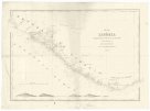 Mapová sbírka Přírodovědecké fakulty UK v PrazeMap of Liberia
 -
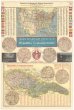 Mapová sbírka Přírodovědecké fakulty UK v PrazeMapa Spojených států S. A. s označením českých osad a Republiky československé
 -
 Mapová sbírka Přírodovědecké fakulty UK v PrazeMapa Československa
 -
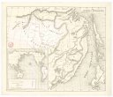 Mapová sbírka Přírodovědecké fakulty UK v PrazeKarta Amurského a Přímorského kraje
 -
 Mapová sbírka Přírodovědecké fakulty UK v PrazeTopographical drawings
 -
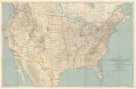 Mapová sbírka Přírodovědecké fakulty UK v PrazeThe United States and adjoining portions of Canada and Mexico
 -
 Mapová sbírka Přírodovědecké fakulty UK v PrazeHonto
 -
 Mapová sbírka Přírodovědecké fakulty UK v PrazeOl'ga
 -
 Mapová sbírka Přírodovědecké fakulty UK v PrazeSamarka.