-
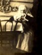
 Národní muzeum - Virtuální muzeumAntonín Rozsypal
 -
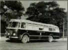 Poštovní muzeumAutomobilová pošta
 -
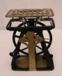
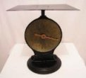 Poštovní muzeumBalíková váha
 -
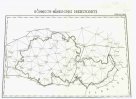
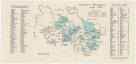
 Mapová sbírka Přírodovědecké fakulty UK v PrazeBevölkerungskarte der Ober- und Niederlausitz auf Grund der Volkszählung 1910
 -
 Mapová sbírka Přírodovědecké fakulty UK v PrazeBöhmisch-mährisches Dreiecksnetz
 -
 Mapová sbírka Přírodovědecké fakulty UK v PrazeCarte comprenant le cours du Danube
 -
 Mapová sbírka Přírodovědecké fakulty UK v PrazeCarte de Rome du 1er au 4me siecle
 -
 Mapová sbírka Přírodovědecké fakulty UK v PrazeCarte internationale de l'empire Romain av 1,000.000e
 -
 Mapová sbírka Přírodovědecké fakulty UK v PrazeDie Stromlage bei Breslau a. 1200
 -
 Národní muzeum - Virtuální muzeumDokumenty Roberta Vobrátilka
 -
 Poštovní muzeumDálnopis - děrovač
 -
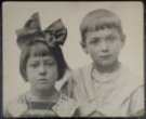
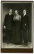 Národní muzeum - Virtuální muzeumDívka mezi dvěma chlapci
 -
 Mapová sbírka Přírodovědecké fakulty UK v PrazeEmpire Ottoman
 -
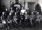
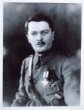
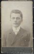
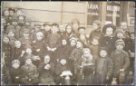
 Národní muzeum - Virtuální muzeumFotografie Klementa Jadrného
 -
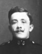
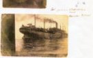
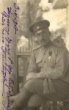
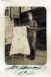
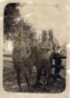
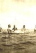
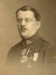
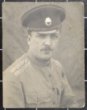
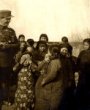
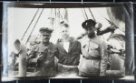
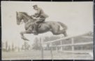
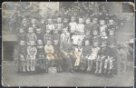
 Národní muzeum - Virtuální muzeumFotografie Roberta Vobrátilka
 -
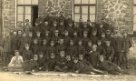
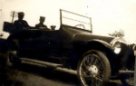
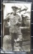
 Národní muzeum - Virtuální muzeumFotografie Roberta Vobrátilka
 -
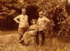
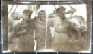
 Národní muzeum - Virtuální muzeumFotografie Roberta Vobrátilka
 -
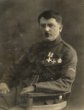
 Národní muzeum - Virtuální muzeumFotografie Roberta Vobrátilka
 -
 Národní muzeum - Virtuální muzeumFotografie Roberta Vobrátilka
 -
 Národní muzeum - Virtuální muzeumFotografie Roberta Vobrátilka
 -
 Národní muzeum - Virtuální muzeumFotografie Roberta Vobrátilka
 -
 Národní muzeum - Virtuální muzeumFotografie Roberta Vobrátilka
 -
 Národní muzeum - Virtuální muzeumFotografie Roberta Vobrátilka
 -
 Národní muzeum - Virtuální muzeumFotografie Roberta Vobrátilka
 -
 Národní muzeum - Virtuální muzeumFotografie Roberta Vobrátilka
 -
 Národní muzeum - Virtuální muzeumFotografie Roberta Vobrátilka
 -
 Národní muzeum - Virtuální muzeumFotografie Roberta Vobrátilka
 -
 Národní muzeum - Virtuální muzeumFotografie Roberta Vobrátilka
 -
 Národní muzeum - Virtuální muzeumFotografie Roberta Vobrátilka
 -
 Národní muzeum - Virtuální muzeumFotografie Roberta Vobrátilka
 -
 Národní muzeum - Virtuální muzeumFotografie Roberta Vobrátilka
 -
 Národní muzeum - Virtuální muzeumFotografie Roberta Vobrátilka
 -
 Národní muzeum - Virtuální muzeumFotografie Roberta Vobrátilka
 -
 Národní muzeum - Virtuální muzeumFotografie Roberta Vobrátilka
 -
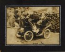
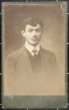
 Národní muzeum - Virtuální muzeumFotografie Václava Emlera
 -
 Národní muzeum - Virtuální muzeumFotografie Václava Emlera
 -
 Národní muzeum - Virtuální muzeumFotografie Václava Emlera
 -
 Národní muzeum - Virtuální muzeumFotografie Václava Emlera
 -
 Národní muzeum - Virtuální muzeumFotografie Václava Emlera
 -
 Národní muzeum - Virtuální muzeumFotografie Václava Emlera
 -
 Národní muzeum - Virtuální muzeumFotografie Václava Emlera
 -
 Národní muzeum - Virtuální muzeumFotografie Václava Emlera
 -
 Národní muzeum - Virtuální muzeumFotografie Václava Emlera
 -
 Národní muzeum - Virtuální muzeumFotografie Václava Emlera
 -
 Národní muzeum - Virtuální muzeumFotografie Václava Emlera
 -
 Národní muzeum - Virtuální muzeumFotografie Václava Emlera
 -
![Grenzkürzung v[on] J[ahre] 1887](/data/cache/media/75/12491147-136x110-1707325406.jpg) Mapová sbírka Přírodovědecké fakulty UK v PrazeGrenzkürzung v[on] J[ahre] 1887
Mapová sbírka Přírodovědecké fakulty UK v PrazeGrenzkürzung v[on] J[ahre] 1887 -
![Grundris der Stat Wienn [sic] wie selbe ist belagert worden von den Türken im Jahr 1683 nebst der christlichen Arme wie selbe zu vier mahlen in Ordnung gestanden wie auch der Marsch durch den Wienner Walt in drey [sic] Colonen.](/data/cache/media/fa/12126859-136x110-1707326508.jpg) Mapová sbírka Přírodovědecké fakulty UK v PrazeGrundris der Stat Wienn [sic] wie selbe ist belagert worden von den Türken im Jahr 1683 nebst der christlichen Arme wie selbe zu vier mahlen in Ordnung gestanden wie auch der Marsch durch den Wienner Walt in drey [sic] Colonen.
Mapová sbírka Přírodovědecké fakulty UK v PrazeGrundris der Stat Wienn [sic] wie selbe ist belagert worden von den Türken im Jahr 1683 nebst der christlichen Arme wie selbe zu vier mahlen in Ordnung gestanden wie auch der Marsch durch den Wienner Walt in drey [sic] Colonen. -
 Mapová sbírka Přírodovědecké fakulty UK v PrazeKarta Černogorii
 -
 Mapová sbírka Přírodovědecké fakulty UK v PrazeKnížetství Frydlantské na poč. r. 1634
 -
 Poštovní muzeumKratiknot
 -
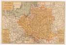 Mapová sbírka Přírodovědecké fakulty UK v PrazeMapa Polski
 -
 Mapová sbírka Přírodovědecké fakulty UK v PrazeMappa comitatus Zagrabiensis
 -
![Mitteleuropas Volksstämme im 1 und 6 J[a]h[rhundert] nach Chr[istus]](/data/cache/media/d7/12491091-136x110-1707326508.jpg) Mapová sbírka Přírodovědecké fakulty UK v PrazeMitteleuropas Volksstämme im 1 und 6 J[a]h[rhundert] nach Chr[istus]
Mapová sbírka Přírodovědecké fakulty UK v PrazeMitteleuropas Volksstämme im 1 und 6 J[a]h[rhundert] nach Chr[istus] -
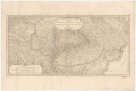
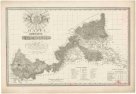
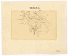 Mapová sbírka Přírodovědecké fakulty UK v PrazeMorea
 -
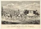 Poštovní muzeumMědiryt Ottenfeldův poštovní rychlík
 -
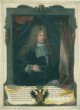 Poštovní muzeumNeznámý autor: Dědičný poštmistr Karl Josef Paar
 -
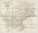
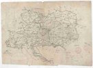 Mapová sbírka Přírodovědecké fakulty UK v PrazeNárodní zeměvid Rakouské říše
 -
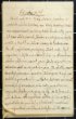
 Národní muzeum - Virtuální muzeumOpis dopisu Adolfa Buriana
 -
![Orbis qualis veteribus not[us]](/data/cache/media/67/12503129-136x110-1707325116.jpg) Mapová sbírka Přírodovědecké fakulty UK v PrazeOrbis qualis veteribus not[us]
Mapová sbírka Přírodovědecké fakulty UK v PrazeOrbis qualis veteribus not[us] -
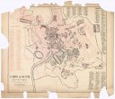
 Mapová sbírka Přírodovědecké fakulty UK v PrazePianta della citta di Firenze rilevata esattamente nell'anno 1783
 -
 Mapová sbírka Přírodovědecké fakulty UK v PrazePlan de la bataille de Waterloo
 -
 Mapová sbírka Přírodovědecké fakulty UK v PrazePlan und Beschreibung der Landes-Grenze
 -
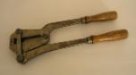 Poštovní muzeumPlombovací kleště
 -
 Mapová sbírka Přírodovědecké fakulty UK v PrazePolska 1586 za Stefana Batorego
 -
 Mapová sbírka Přírodovědecké fakulty UK v PrazePolska czyli Lechja 1139 między synov Krzivoustego podzielona
 -
 Poštovní muzeumPošta Kvilda
 -
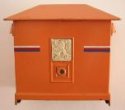
 Poštovní muzeumPoštovní schránka
 -
 Poštovní muzeumPoštovní schránka systému „Zemánek“
 -
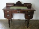 Poštovní muzeumPsací stůl
 -
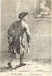
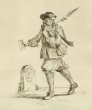 Poštovní muzeumPěší posel z počátku 18. století
 -
![Přehled k maďarské mapě 1:50 000 z r[oku] 1943](/data/cache/media/98/12193677-136x110-1707326418.jpg) Mapová sbírka Přírodovědecké fakulty UK v PrazePřehled k maďarské mapě 1:50 000 z r[oku] 1943
Mapová sbírka Přírodovědecké fakulty UK v PrazePřehled k maďarské mapě 1:50 000 z r[oku] 1943 -
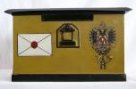 Poštovní muzeumRakouská schránka tzv. II velikosti
 -
 Národní muzeum - Virtuální muzeumRaymund Mrázek
 -
 Mapová sbírka Přírodovědecké fakulty UK v PrazeSchema Jero Röm. Kaiserl. zu hung. u. Böhmen Königl. Majestät, regulirten Regmtr zu Fuß und zu Pferd
 -
 Poštovní muzeumSebastian Mansfeld: Posel klapačkové pošty
 -
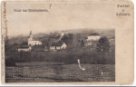 Národní muzeum - Virtuální muzeumSobišovice
 -
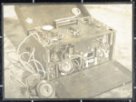
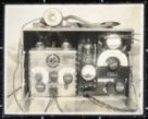
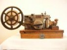 Poštovní muzeumSovětský telegrafní přístroj Morse
 -
 Mapová sbírka Přírodovědecké fakulty UK v PrazeStrassen Karte des Lombardisch-Venezianischen Koenigreiches
 -
 Mapová sbírka Přírodovědecké fakulty UK v PrazeSłaviańszczyzna Polska 992 za Mieczysłava
 -
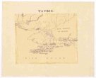 Mapová sbírka Přírodovědecké fakulty UK v PrazeTavrie
 -
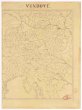 Mapová sbírka Přírodovědecké fakulty UK v PrazeVindové
 -
 Národní muzeum - Virtuální muzeumVzpomínky Jaroslava Kaňky
 -
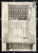
 Poštovní muzeumVáhy listovní automatické
 -
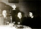
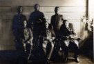
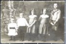
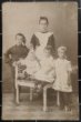
 Národní muzeum - Virtuální muzeumVěra Špačková a její rodina
 -
 Národní muzeum - Virtuální muzeumVěra Špačková a její rodina
 -
 Národní muzeum - Virtuální muzeumVěra Špačková a její rodina
 -
 Národní muzeum - Virtuální muzeumVěra Špačková a její rodina
 -
 Národní muzeum - Virtuální muzeumVěra Špačková a její rodina
 -
 Národní muzeum - Virtuální muzeumVěra Špačková a její rodina
 -
 Národní muzeum - Virtuální muzeumVěra Špačková a její rodina
 -
 Mapová sbírka Přírodovědecké fakulty UK v PrazeZahl der Bauern des Egerlandes im Jahre 1395
 -
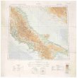
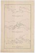
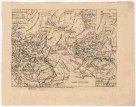
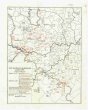
![[Balkánský poloostrov] : [řeky, sídla, stupně]](/data/cache/media/68/12083001-136x110-1714983147.jpg) Mapová sbírka Přírodovědecké fakulty UK v Praze[Balkánský poloostrov] : [řeky, sídla, stupně]
Mapová sbírka Přírodovědecké fakulty UK v Praze[Balkánský poloostrov] : [řeky, sídla, stupně] -
![[Blgarija]](/data/cache/media/7f/12063313-136x110-1709163550.jpg) Mapová sbírka Přírodovědecké fakulty UK v Praze[Blgarija]
Mapová sbírka Přírodovědecké fakulty UK v Praze[Blgarija] -
![[Gentis Montenegrianæ]](/data/cache/media/34/12063298-136x110-1709163550.jpg) Mapová sbírka Přírodovědecké fakulty UK v Praze[Gentis Montenegrianæ]
Mapová sbírka Přírodovědecké fakulty UK v Praze[Gentis Montenegrianæ] -
![[Serbia]](/data/cache/media/33/12063253-136x110-1708012677.jpg) Mapová sbírka Přírodovědecké fakulty UK v Praze[Serbia]
Mapová sbírka Přírodovědecké fakulty UK v Praze[Serbia]