-
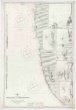
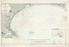
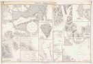
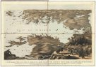 Mapová sbírka Přírodovědecké fakulty UK v PrazeA panoramic view of the Gulf of Finland & the Baltic sea, with the fortified places from the Aland isles to St. Petersburg
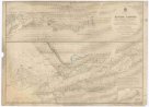
 -
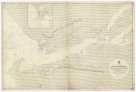
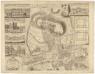
 Mapová sbírka Přírodovědecké fakulty UK v PrazeA plan of the castle of Chester
 -
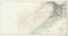
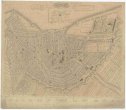
 Mapová sbírka Přírodovědecké fakulty UK v PrazeA plan of the city of Bristol
 -
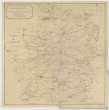 Mapová sbírka Přírodovědecké fakulty UK v PrazeA sketch of the roads within fourteen miles of Tunbridge Wells
 -
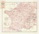 Mapová sbírka Přírodovědecké fakulty UK v PrazeAA service map of France
 -
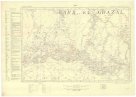 Mapová sbírka Přírodovědecké fakulty UK v PrazeAfrica 1:1,000,000
 -
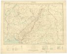 Mapová sbírka Přírodovědecké fakulty UK v PrazeAfrica 1:2 000 000
 -
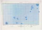 Mapová sbírka Přírodovědecké fakulty UK v PrazeAfrica 1:2,000,000
 -
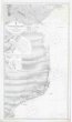 Mapová sbírka Přírodovědecké fakulty UK v PrazeAfrica, east coast
 -
 Mapová sbírka Přírodovědecké fakulty UK v PrazeAfrica, west coast
 -
 Mapová sbírka Přírodovědecké fakulty UK v PrazeAfrika west coast
 -
 Mapová sbírka Přírodovědecké fakulty UK v PrazeAfrika west coast
 -
 Mapová sbírka Přírodovědecké fakulty UK v PrazeAlexandria Harbour
 -
 Mapová sbírka Přírodovědecké fakulty UK v PrazeAlgoa Bay
 -
 Mapová sbírka Přírodovědecké fakulty UK v PrazeAmsterdam
 -
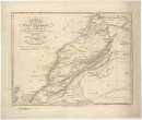 Mapová sbírka Přírodovědecké fakulty UK v PrazeAn accurate map of west Barbary, including Suse & Tafilelt, forming the dominions of the present emperor of Marocco
 -
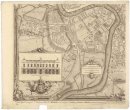
 Mapová sbírka Přírodovědecké fakulty UK v PrazeAn exact plan of the gardens and park at Wilton the seat of Henry Earl of Pembroke
 -
 Mapová sbírka Přírodovědecké fakulty UK v PrazeAnchorages in Spitsbergen and Bear Island
 -
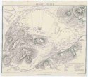 Mapová sbírka Přírodovědecké fakulty UK v PrazeAncient Athens
 -
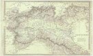 Mapová sbírka Přírodovědecké fakulty UK v PrazeAncient Italy.
 -
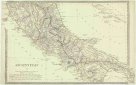 Mapová sbírka Přírodovědecké fakulty UK v PrazeAncient Italy.
 -
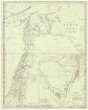 Mapová sbírka Přírodovědecké fakulty UK v PrazeAncient Syria
 -
 Mapová sbírka Přírodovědecké fakulty UK v PrazeAntarctic Ocean
 -
 Mapová sbírka Přírodovědecké fakulty UK v PrazeAntarctic Ocean