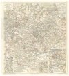
Wanderkarte des Teplitzer Gebirgsvereines für das Erz- und Mittelgebirge
description
Barev. litografie 58,5 x 46,5 cm na listu 63,5 x 51 cm Měřítko 1:75 000 (013°22´52" v.d.--014°02´06" v.d./050°49´11" s.š.--050°21´34" s.š.)
- institution
- Mapová sbírka Přírodovědecké fakulty UK v Praze
- subcollection
- Mapová sbírka
- type
- Mapy
- subject author
- C.C. Meinhold & Söhne
- date of issue
- 1920-1940
- document publisher
- Teplitzer Gebirgsverein
- language
- Němčina
- origin
- Ústecký kraj, Teplitz
- material
- Papír
- original owner
- Razítko Čsl. akademie věd, kabinet pro kartografii.
- inventory number
- 1424885
next subjects
-
 Mapová sbírka Přírodovědecké fakulty UK v PrazeWanderkarte fürs Elbetal und des angrenzenden Gebietes vom Mittel- und Erzgebirge
 -
 Mapová sbírka Přírodovědecké fakulty UK v PrazeZemě slovenská
 -
![[Tetschen und Umgebung]](/data/cache/media/42/12339437-136x110-1715761119.jpg) Mapová sbírka Přírodovědecké fakulty UK v Praze[Tetschen und Umgebung]
Mapová sbírka Přírodovědecké fakulty UK v Praze[Tetschen und Umgebung] -
![[Tetschen und Umgebung]](/data/cache/media/c8/12339442-136x110-1715761119.jpg) Mapová sbírka Přírodovědecké fakulty UK v Praze[Tetschen und Umgebung]
Mapová sbírka Přírodovědecké fakulty UK v Praze[Tetschen und Umgebung] -
![[Tetschen und Umgebung]](/data/cache/media/89/12381431-136x110-1715761119.jpg) Mapová sbírka Přírodovědecké fakulty UK v Praze[Tetschen und Umgebung]
Mapová sbírka Přírodovědecké fakulty UK v Praze[Tetschen und Umgebung] -
![[Tetschen und Umgebung]](/data/cache/media/89/12381445-136x110-1715761120.jpg) Mapová sbírka Přírodovědecké fakulty UK v Praze[Tetschen und Umgebung]
Mapová sbírka Přírodovědecké fakulty UK v Praze[Tetschen und Umgebung] -
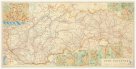
 Mapová sbírka Přírodovědecké fakulty UK v PrazeÜbersichtskarte des vom Teplitzer Gebirgsvereine markierten Gebietes im Erz- und Mittelgebirge
 -
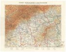
 Mapová sbírka Přírodovědecké fakulty UK v PrazeČechy
 -
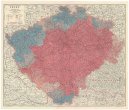
 Mapová sbírka Přírodovědecké fakulty UK v PrazeČeské středohoří a Krušnohoří