-
 Mapová sbírka Přírodovědecké fakulty UK v PrazeParish of East Barron, County of Nares
 -
 Mapová sbírka Přírodovědecké fakulty UK v PrazeParish of Herberton, county of Cardwell
 -
 Mapová sbírka Přírodovědecké fakulty UK v PrazePlan of River Murray between Morgan and province boundary
 -
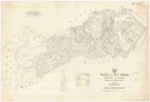
 Mapová sbírka Přírodovědecké fakulty UK v PrazePlan of country between River Murray and Pinnaroo railway
 -
 Mapová sbírka Přírodovědecké fakulty UK v PrazePlan of portions 3 & 4 parish of Blairgowrie Charlotte Plains 1/4 resumption and portion 2 parish of Bellanda Telemon 1/4 resumption, county of Dutton
 -
 Mapová sbírka Přírodovědecké fakulty UK v PrazePlan of portions 5 & 6 parish of Malden, county of Beaufort
 -
 Mapová sbírka Přírodovědecké fakulty UK v PrazePlan of portions 8 to 11 parish of Avington, Avington resumption, county of Youranigh
 -
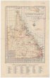 Mapová sbírka Přírodovědecké fakulty UK v PrazeQueensland
 -
 Mapová sbírka Přírodovědecké fakulty UK v PrazeQueensland four mile maps
 -
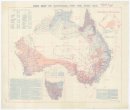 Mapová sbírka Přírodovědecké fakulty UK v PrazeRain map of Australia for the year 1909
 -
 Mapová sbírka Přírodovědecké fakulty UK v PrazeRain map of Australia for the year 1922
 -
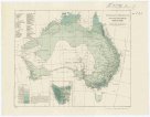
 Mapová sbírka Přírodovědecké fakulty UK v PrazeRainfall of Australia
 -
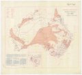
 Mapová sbírka Přírodovědecké fakulty UK v PrazeRevised average annual rainfall map
 -
 Mapová sbírka Přírodovědecké fakulty UK v PrazeSavaii
 -
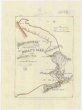
 Mapová sbírka Přírodovědecké fakulty UK v PrazeSketch map of Cape York peninsula
 -
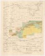
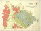
 Mapová sbírka Přírodovědecké fakulty UK v PrazeSketch map of New South Wales showing the localities of the principal minerals
 -
 Mapová sbírka Přírodovědecké fakulty UK v PrazeSketch map of east central Queensland
 -
 Mapová sbírka Přírodovědecké fakulty UK v PrazeSketch map of goldfields in the vicinity of Charters Towers
 -
 Mapová sbírka Přírodovědecké fakulty UK v PrazeSketch map of portions 57 & 58 parish of Tinaroo, county of Nares
 -
 Mapová sbírka Přírodovědecké fakulty UK v PrazeSketch map of portions 6 to 13 & 15 to 32 parish of Greenup, portions 8 to 11 parish of Plassey and portions 174 to 177 parish of Coolmunda countries of Clive & Bentinck
 -
 Mapová sbírka Přírodovědecké fakulty UK v PrazeSketch map of the Croydon & Etheridge goldfields
 -
 Mapová sbírka Přírodovědecké fakulty UK v PrazeSketch map of the Etheridge goldfield
 -
 Mapová sbírka Přírodovědecké fakulty UK v PrazeSketch map shewing rabbit board districts and rabbit proof fence, Queensland
 -
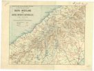 Mapová sbírka Přírodovědecké fakulty UK v PrazeSouth Westland and central portion of Southern Alps
 -
 Mapová sbírka Přírodovědecké fakulty UK v PrazeTarwin South
 -
 Mapová sbírka Přírodovědecké fakulty UK v PrazeThe Blue Mountains
 -
 Mapová sbírka Přírodovědecké fakulty UK v PrazeThe catchment areas of the Brisbane River and of the Logan and Albert Rivers &c.
 -
 Mapová sbírka Přírodovědecké fakulty UK v PrazeThowgla and part of Kangobin
 -
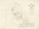
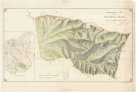
 Mapová sbírka Přírodovědecké fakulty UK v PrazeTopographical map of Hills district between Adelaide & the Bremer Ranges
 -
 Mapová sbírka Přírodovědecké fakulty UK v PrazeTopographical plan of the National Park Hd. of Adelaide
 -
 Mapová sbírka Přírodovědecké fakulty UK v PrazeTourists sketch map
 -
 Mapová sbírka Přírodovědecké fakulty UK v PrazeTowong
 -
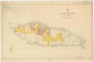 Mapová sbírka Přírodovědecké fakulty UK v PrazeUpolu
 -
 Mapová sbírka Přírodovědecké fakulty UK v PrazeWaratah North
 -
 Mapová sbírka Přírodovědecké fakulty UK v PrazeWelshpool
 -
 Mapová sbírka Přírodovědecké fakulty UK v PrazeWide Bay
 -
 Mapová sbírka Přírodovědecké fakulty UK v PrazeWonderland, the Hot Lakes region
 -
 Mapová sbírka Přírodovědecké fakulty UK v PrazeWonyip
 -
![[South Australia]](/data/cache/media/d6/12478711-136x110-1715758842.jpg) Mapová sbírka Přírodovědecké fakulty UK v Praze[South Australia]
Mapová sbírka Přírodovědecké fakulty UK v Praze[South Australia] -
![[Western Australia]](/data/cache/media/a3/12478221-136x110-1715764059.jpg) Mapová sbírka Přírodovědecké fakulty UK v Praze[Western Australia]
Mapová sbírka Přírodovědecké fakulty UK v Praze[Western Australia]