-
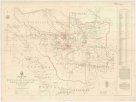
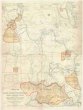
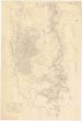
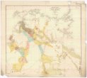 Mapová sbírka Přírodovědecké fakulty UK v PrazeGeological map of the Northern Territory of South Australia
 -
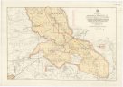
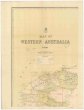 Mapová sbírka Přírodovědecké fakulty UK v PrazeMap of Western Australia
 -
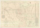
 Mapová sbírka Přírodovědecké fakulty UK v PrazeMap of Queensland
 -
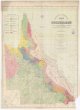
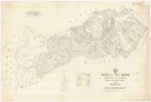
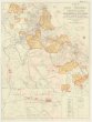
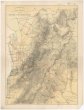
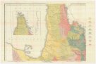 Mapová sbírka Přírodovědecké fakulty UK v PrazeGeological map of Queensland
 -
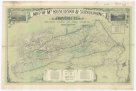
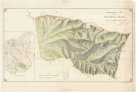 Mapová sbírka Přírodovědecké fakulty UK v PrazeTopographical plan of the National Park Hd. of Adelaide
 -
 Mapová sbírka Přírodovědecké fakulty UK v PrazeCopper mining district of Cloncurry, north western Queensland
 -
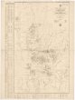
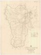
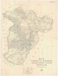
 Mapová sbírka Přírodovědecké fakulty UK v PrazeCounty of Livingstone
 -
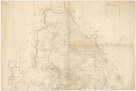
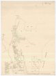
 Mapová sbírka Přírodovědecké fakulty UK v PrazeParish of Bellender Ker, County of Nares
 -
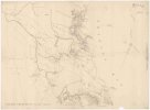
 Mapová sbírka Přírodovědecké fakulty UK v PrazeSketch map of the Etheridge goldfield
 -
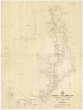
 Mapová sbírka Přírodovědecké fakulty UK v PrazeParish of East Barron, County of Nares
 -
 Mapová sbírka Přírodovědecké fakulty UK v PrazeCounty of Clinton
 -
 Mapová sbírka Přírodovědecké fakulty UK v PrazeEnvirons of Cairns
 -
![[Western Australia]](/data/cache/media/a3/12478221-136x110-1715764059.jpg) Mapová sbírka Přírodovědecké fakulty UK v Praze[Western Australia]
Mapová sbírka Přírodovědecké fakulty UK v Praze[Western Australia] -
 Mapová sbírka Přírodovědecké fakulty UK v PrazeSketch map of Cape York peninsula
 -
 Mapová sbírka Přírodovědecké fakulty UK v PrazeSketch map of east central Queensland
 -
 Mapová sbírka Přírodovědecké fakulty UK v PrazeSketch map of goldfields in the vicinity of Charters Towers
 -
 Mapová sbírka Přírodovědecké fakulty UK v PrazeSketch map of the Croydon & Etheridge goldfields
 -
 Mapová sbírka Přírodovědecké fakulty UK v PrazeCounty of Nares
 -
 Mapová sbírka Přírodovědecké fakulty UK v PrazeMap of county of Fitzroy
 -
 Mapová sbírka Přírodovědecké fakulty UK v PrazeCook 2 mile map
 -
 Mapová sbírka Přírodovědecké fakulty UK v PrazeCook district 2 mile sketch map
 -
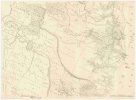
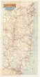 Mapová sbírka Přírodovědecké fakulty UK v PrazeMap of the north eastern tourist district
 -
 Mapová sbírka Přírodovědecké fakulty UK v PrazeTopographical map of Hills district between Adelaide & the Bremer Ranges
 -
 Mapová sbírka Přírodovědecké fakulty UK v PrazeMap of M.t Kosciusko & surrounding districts