-
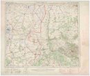 Mapová sbírka Přírodovědecké fakulty UK v Praze1:250 000 Europe
 -
 Mapová sbírka Přírodovědecké fakulty UK v Praze1:250 000 Europe
 -
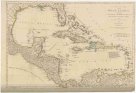 Mapová sbírka Přírodovědecké fakulty UK v PrazeA COMPLEAT MAP OF THE WEST INDIES
 -
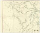
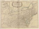 Mapová sbírka Přírodovědecké fakulty UK v PrazeA GENERAL MAP OF THE MIDDLE BRITISH COLONIES IN AMERICA
 -
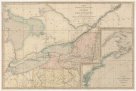
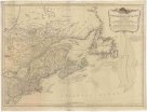 Mapová sbírka Přírodovědecké fakulty UK v PrazeA GENERAL MAP OF THE NORTHERN BRITISH COLONIES IN AMERICA
 -
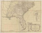 Mapová sbírka Přírodovědecké fakulty UK v PrazeA GENERAL MAP OF THE SOUTHERN BRITISH COLONIES IN AMERICA
 -
 Mapová sbírka Přírodovědecké fakulty UK v PrazeA MAP EXHIBITING THE FRONTIERS of CANADA and the UNITED STATES
 -
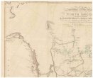 Mapová sbírka Přírodovědecké fakulty UK v PrazeA MAP Exhibiting all the New Discoveries in the Interior Parts of NORTH AMERICA
 -
 Mapová sbírka Přírodovědecké fakulty UK v PrazeA MAP OF THE UNITED STATES of NORTH AMERICA
 -
 Mapová sbírka Přírodovědecké fakulty UK v PrazeA MAP of HINDOOSTAN, or the MOGUL EMPIRE
 -
 Mapová sbírka Přírodovědecké fakulty UK v PrazeA Map OF EUROPE
 -
 Mapová sbírka Přírodovědecké fakulty UK v PrazeA SURVEY OF LAKE CHAMPLAIN
 -
 Mapová sbírka Přírodovědecké fakulty UK v PrazeA chart of the Canary islands, including Madeira
 -
 Mapová sbírka Přírodovědecké fakulty UK v PrazeA general map of Turkey in Europe, Hungary &c.
 -
 Mapová sbírka Přírodovědecké fakulty UK v PrazeA map of Scotland
 -
 Mapová sbírka Přírodovědecké fakulty UK v PrazeA map of old & new Castile
 -
 Mapová sbírka Přírodovědecké fakulty UK v PrazeA map of the Nile, from the equatorial lakes to the Mediterranean
 -
 Mapová sbírka Přírodovědecké fakulty UK v PrazeA new an exact map of ey south west part of France
 -
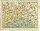 Mapová sbírka Přírodovědecké fakulty UK v PrazeA new and accurate map of Saxony, part of Brandenburg, Silesia, Poland and Bohemia
 -
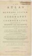 Mapová sbírka Přírodovědecké fakulty UK v PrazeA new atlas of the mundane system, or, of geograpy and cosmography
 -
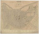
 Mapová sbírka Přírodovědecké fakulty UK v PrazeA new complete & correct map of Southampton and its suburban district
 -
 Mapová sbírka Přírodovědecké fakulty UK v PrazeA new map of Bohemia and Moravia
 -
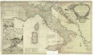 Mapová sbírka Přírodovědecké fakulty UK v PrazeA new map of Italy distinguishing all the sovereignties in it, whether states, kingdoms, dutchies, principalities, republicks & c.
 -
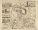
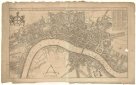 Mapová sbírka Přírodovědecké fakulty UK v PrazeA new mapp of the city of London
 -
 Mapová sbírka Přírodovědecké fakulty UK v PrazeA panoramic view of the Gulf of Finland & the Baltic sea, with the fortified places from the Aland isles to St. Petersburg
 -
 Mapová sbírka Přírodovědecké fakulty UK v PrazeA plan of the castle of Chester
 -
 Mapová sbírka Přírodovědecké fakulty UK v PrazeA plan of the city of Bristol
 -
 Mapová sbírka Přírodovědecké fakulty UK v PrazeA sketch of the roads within fourteen miles of Tunbridge Wells
 -
 Mapová sbírka Přírodovědecké fakulty UK v PrazeAA service map of France
 -
 Mapová sbírka Přírodovědecké fakulty UK v PrazeAfrica 1:1,000,000
 -
 Mapová sbírka Přírodovědecké fakulty UK v PrazeAfrica 1:2 000 000
 -
 Mapová sbírka Přírodovědecké fakulty UK v PrazeAfrica 1:2,000,000
 -
 Mapová sbírka Přírodovědecké fakulty UK v PrazeAfrica, east coast
 -
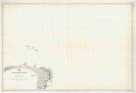
 Mapová sbírka Přírodovědecké fakulty UK v PrazeAfrica, west coast
 -
 Mapová sbírka Přírodovědecké fakulty UK v PrazeAfrika west coast
 -
 Mapová sbírka Přírodovědecké fakulty UK v PrazeAfrika west coast
 -
 Mapová sbírka Přírodovědecké fakulty UK v PrazeAlexandria Harbour
 -
 Mapová sbírka Přírodovědecké fakulty UK v PrazeAlgoa Bay
 -
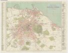
 Mapová sbírka Přírodovědecké fakulty UK v PrazeAmsterdam
 -
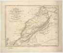 Mapová sbírka Přírodovědecké fakulty UK v PrazeAn accurate map of west Barbary, including Suse & Tafilelt, forming the dominions of the present emperor of Marocco
 -
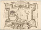
 Mapová sbírka Přírodovědecké fakulty UK v PrazeAn exact plan of the gardens and park at Wilton the seat of Henry Earl of Pembroke
 -
 Mapová sbírka Přírodovědecké fakulty UK v PrazeAnchorages in Spitsbergen and Bear Island
 -
 Mapová sbírka Přírodovědecké fakulty UK v PrazeAncient Athens
 -
 Mapová sbírka Přírodovědecké fakulty UK v PrazeAncient Italy.
 -
 Mapová sbírka Přírodovědecké fakulty UK v PrazeAncient Italy.
 -
 Mapová sbírka Přírodovědecké fakulty UK v PrazeAncient Syria
 -
 Mapová sbírka Přírodovědecké fakulty UK v PrazeAntarctic Ocean
 -
 Mapová sbírka Přírodovědecké fakulty UK v PrazeAntarctic Ocean
 -
 Mapová sbírka Přírodovědecké fakulty UK v PrazeAntarctic Ocean
 -
 Mapová sbírka Přírodovědecké fakulty UK v PrazeAntarctic Ocean
 -
 Mapová sbírka Přírodovědecké fakulty UK v PrazeAntarctic Ocean
 -
 Mapová sbírka Přírodovědecké fakulty UK v PrazeAntarctic Ocean
 -
 Mapová sbírka Přírodovědecké fakulty UK v PrazeAntarctic Ocean
 -
 Mapová sbírka Přírodovědecké fakulty UK v PrazeAntarctic Ocean
 -
 Mapová sbírka Přírodovědecké fakulty UK v PrazeApproches to Bergen
 -
 Mapová sbírka Přírodovědecké fakulty UK v PrazeArabian Sea
 -
 Mapová sbírka Přírodovědecké fakulty UK v PrazeArctic Sea
 -
 Mapová sbírka Přírodovědecké fakulty UK v PrazeArctic Sea, northward from Baffin Bay
 -
 Mapová sbírka Přírodovědecké fakulty UK v PrazeArctic ocean, North coast of Siberia
 -
 Mapová sbírka Přírodovědecké fakulty UK v PrazeAsia
 -
 Mapová sbírka Přírodovědecké fakulty UK v PrazeAsia 1:1,000,000
 -
 Mapová sbírka Přírodovědecké fakulty UK v PrazeAsia 1:4 000 000
 -
 Mapová sbírka Přírodovědecké fakulty UK v PrazeAsia Minor
 -
 Mapová sbírka Přírodovědecké fakulty UK v PrazeAthend to the isthmus of Corinth
 -
 Mapová sbírka Přírodovědecké fakulty UK v PrazeAthens
 -
 Mapová sbírka Přírodovědecké fakulty UK v PrazeAtlas, containing ten maps of Poland
 -
 Mapová sbírka Přírodovědecké fakulty UK v PrazeAutriche
 -
 Mapová sbírka Přírodovědecké fakulty UK v PrazeBacon's motoring map of England & Wales
 -
 Mapová sbírka Přírodovědecké fakulty UK v PrazeBacon's new plan of Liverpool
 -
 Mapová sbírka Přírodovědecké fakulty UK v PrazeBalearic islands ; Corsica, and Sardinia ; Valetta, the capital of Malta
 -
 Mapová sbírka Přírodovědecké fakulty UK v PrazeBartholomew's "Half-inch to mile" map of Scotland
 -
 Mapová sbírka Přírodovědecké fakulty UK v PrazeBartholomew's "Quarter to mile" road map of the environs of London
 -
 Mapová sbírka Přírodovědecké fakulty UK v PrazeBartholomew's Quarter-inch to mile" map of Ireland
 -
 Mapová sbírka Přírodovědecké fakulty UK v PrazeBartholomew's Quarter-inch to mile" map of Ireland
 -
 Mapová sbírka Přírodovědecké fakulty UK v PrazeBartholomew's pocket map of the environs of Glasgow
 -
 Mapová sbírka Přírodovědecké fakulty UK v PrazeBartholomew's pocket plan of Edinburgh & Suburbs
 -
 Mapová sbírka Přírodovědecké fakulty UK v PrazeBay of Fundy
 -
 Mapová sbírka Přírodovědecké fakulty UK v PrazeBelfast.
 -
 Mapová sbírka Přírodovědecké fakulty UK v PrazeBelgium 1:40 000
 -
 Mapová sbírka Přírodovědecké fakulty UK v PrazeBerlin
 -
 Mapová sbírka Přírodovědecké fakulty UK v PrazeBetts's portable terrestrial globe
 -
 Mapová sbírka Přírodovědecké fakulty UK v PrazeBetts's tour through England & Wales
 -
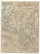
 Mapová sbírka Přírodovědecké fakulty UK v PrazeBohemia
 -
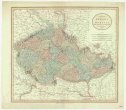
 Mapová sbírka Přírodovědecké fakulty UK v PrazeBohemia & Moravia.
 -
 Mapová sbírka Přírodovědecké fakulty UK v PrazeBokhara, Cabool, Beloochistan & c.
 -
 Mapová sbírka Přírodovědecké fakulty UK v PrazeBokhara, Cabool, Beloochistan &c.
 -
 Mapová sbírka Přírodovědecké fakulty UK v PrazeBombay Harbour
 -
 Mapová sbírka Přírodovědecké fakulty UK v PrazeBooty's hunting map & environs of Brighton
 -
 Mapová sbírka Přírodovědecké fakulty UK v PrazeBowles's new pocket plan of the cities of London and Westminster, with the borough of Southwark
 -
 Mapová sbírka Přírodovědecké fakulty UK v PrazeBowles's reduced new pocket plan of the cities of London
 -
 Mapová sbírka Přírodovědecké fakulty UK v PrazeBrazil, Bahia de Guanabara
 -
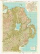
 Mapová sbírka Přírodovědecké fakulty UK v PrazeBritain in the Dark Ages
 -
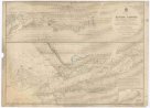
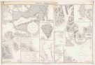
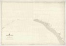
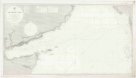
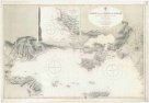
![C[ape] St Francis to Waterloo Bay](/data/cache/media/3e/12493868-136x110-1715764493.jpg) Mapová sbírka Přírodovědecké fakulty UK v PrazeC[ape] St Francis to Waterloo Bay
Mapová sbírka Přírodovědecké fakulty UK v PrazeC[ape] St Francis to Waterloo Bay -
 Mapová sbírka Přírodovědecké fakulty UK v PrazeCalcutta
 -
 Mapová sbírka Přírodovědecké fakulty UK v PrazeCambridgeshire
 -
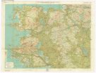
 Mapová sbírka Přírodovědecké fakulty UK v PrazeCanada, eastern