-
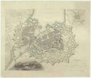
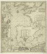
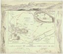
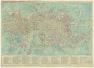
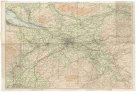
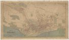
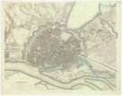 Mapová sbírka Přírodovědecké fakulty UK v PrazeHamburg
 -
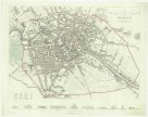 Mapová sbírka Přírodovědecké fakulty UK v PrazeBerlin
 -
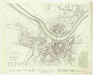 Mapová sbírka Přírodovědecké fakulty UK v PrazeDresden
 -
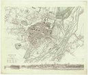 Mapová sbírka Přírodovědecké fakulty UK v PrazeMunich
 -
 Mapová sbírka Přírodovědecké fakulty UK v PrazeGeneva
 -
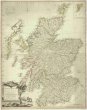
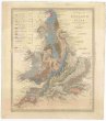
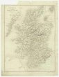 Mapová sbírka Přírodovědecké fakulty UK v PrazeA map of Scotland
 -
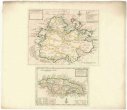 Mapová sbírka Přírodovědecké fakulty UK v PrazeThe island of Antego
 -
 Mapová sbírka Přírodovědecké fakulty UK v PrazeBohemia & Moravia.
 -
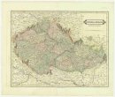
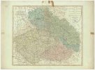
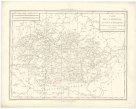
 Mapová sbírka Přírodovědecké fakulty UK v PrazeA new map of Bohemia and Moravia
 -
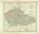
 Mapová sbírka Přírodovědecké fakulty UK v PrazeBohemia
 -
 Mapová sbírka Přírodovědecké fakulty UK v PrazeThe kingdom of Bohemia with the dutchy of Silesia and the marquisates of Moravia and Lusatia
 -
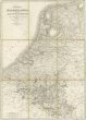
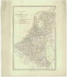 Mapová sbírka Přírodovědecké fakulty UK v PrazeThe Kingdom of the Netherlands
 -
 Mapová sbírka Přírodovědecké fakulty UK v PrazeThe seat of war on the coast of France being a new chart of the coast of Holland, Flanders, France, Spain & Portugal, with the adjacent islands, part of Barbary, England and Ireland
 -
 Mapová sbírka Přírodovědecké fakulty UK v PrazeA new map of Italy distinguishing all the sovereignties in it, whether states, kingdoms, dutchies, principalities, republicks & c.
 -
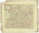
 Mapová sbírka Přírodovědecké fakulty UK v PrazeA new and accurate map of Saxony, part of Brandenburg, Silesia, Poland and Bohemia
 -
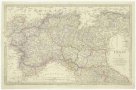
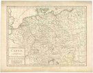
 Mapová sbírka Přírodovědecké fakulty UK v PrazeGermany
 -
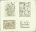
 Mapová sbírka Přírodovědecké fakulty UK v PrazeAthens
 -
 Mapová sbírka Přírodovědecké fakulty UK v PrazeThe world as known to the ancients
 -
 Mapová sbírka Přírodovědecké fakulty UK v PrazeThe eastern part of the ancient Persian empire
 -
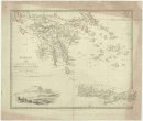
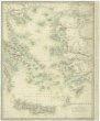 Mapová sbírka Přírodovědecké fakulty UK v PrazeGrecian archipelago
 -
 Mapová sbírka Přírodovědecké fakulty UK v PrazeAncient Syria
 -
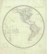 Mapová sbírka Přírodovědecké fakulty UK v PrazeWestern hemisphere
 -
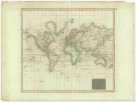 Mapová sbírka Přírodovědecké fakulty UK v PrazeHydrographical chart of the world on Wright or Mercator projection.
 -
 Mapová sbírka Přírodovědecké fakulty UK v PrazeCarte Générale des états du Roi de Sardaigne
 -
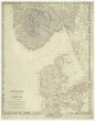 Mapová sbírka Přírodovědecké fakulty UK v PrazeDenmark and part of Norway (Denmark, Norge)
 -
 Mapová sbírka Přírodovědecké fakulty UK v PrazeThe southern provinces of Sweden (Sverige)
 -
 Mapová sbírka Přírodovědecké fakulty UK v PrazeThe northern provinces of Sweden and Norway with part I, of Russia
 -
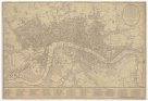
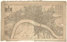
 Mapová sbírka Přírodovědecké fakulty UK v PrazeLondon
 -
 Mapová sbírka Přírodovědecké fakulty UK v PrazeHamp Shire ; Berk Shire ; Wilt Shire
 -
 Mapová sbírka Přírodovědecké fakulty UK v PrazeBowles's reduced new pocket plan of the cities of London
 -
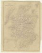
 Mapová sbírka Přírodovědecké fakulty UK v PrazeNorth Britain or Scotland divided into its counties
 -
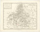
 Mapová sbírka Přírodovědecké fakulty UK v PrazeCarte physique et routiere de l'Ecosse
 -
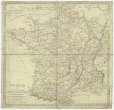 Mapová sbírka Přírodovědecké fakulty UK v PrazeFrance in provinces
 -
 Mapová sbírka Přírodovědecké fakulty UK v PrazeA chart of the Canary islands, including Madeira
 -
 Mapová sbírka Přírodovědecké fakulty UK v PrazeBalearic islands ; Corsica, and Sardinia ; Valetta, the capital of Malta
 -
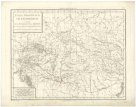
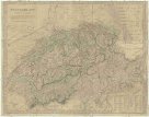 Mapová sbírka Přírodovědecké fakulty UK v PrazeSwitzerland
 -
 Mapová sbírka Přírodovědecké fakulty UK v PrazeCarte physique et routiere de la Suisse
 -
 Mapová sbírka Přírodovědecké fakulty UK v PrazeBokhara, Cabool, Beloochistan &c.
 -
 Mapová sbírka Přírodovědecké fakulty UK v PrazeWestern Siberia, independent Tartary Khiva, Bokhara &c.
 -
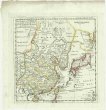 Mapová sbírka Přírodovědecké fakulty UK v PrazeThe empire of China and island of Iapan
 -
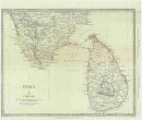 Mapová sbírka Přírodovědecké fakulty UK v PrazeIndia
 -
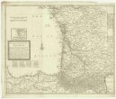 Mapová sbírka Přírodovědecké fakulty UK v PrazeA new an exact map of ey south west part of France
 -
 Mapová sbírka Přírodovědecké fakulty UK v PrazeA map of old & new Castile
 -
 Mapová sbírka Přírodovědecké fakulty UK v PrazeRussia or Moscovy
 -
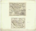
 Mapová sbírka Přírodovědecké fakulty UK v PrazeTurkey.
 -
 Mapová sbírka Přírodovědecké fakulty UK v PrazeTurkey.
 -
 Mapová sbírka Přírodovědecké fakulty UK v PrazeA general map of Turkey in Europe, Hungary &c.
 -
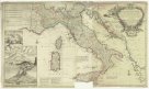
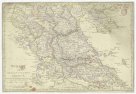
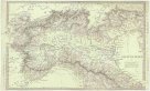
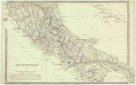
 Mapová sbírka Přírodovědecké fakulty UK v PrazeItaly.
 -
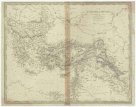 Mapová sbírka Přírodovědecké fakulty UK v PrazeThe Turkish empire in Europe and Asia with the Kingdom of Greece
 -
 Mapová sbírka Přírodovědecké fakulty UK v PrazeTurkey.
 -
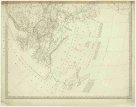
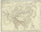 Mapová sbírka Přírodovědecké fakulty UK v PrazeAsia
 -
 Mapová sbírka Přírodovědecké fakulty UK v PrazeAmsterdam
 -
 Mapová sbírka Přírodovědecké fakulty UK v PrazeAncient Italy.
 -
 Mapová sbírka Přírodovědecké fakulty UK v PrazeAncient Italy.
 -
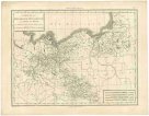
 Mapová sbírka Přírodovědecké fakulty UK v PrazeGermany (Deutschland).
 -
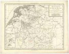
 Mapová sbírka Přírodovědecké fakulty UK v PrazeGermany (Deutschland).
 -
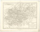
 Mapová sbírka Přírodovědecké fakulty UK v PrazeGermany (Deutschland).
 -
 Mapová sbírka Přírodovědecké fakulty UK v PrazeDwinae fluvii nova descripto
 -
 Mapová sbírka Přírodovědecké fakulty UK v PrazeBartholomew's pocket map of the environs of Glasgow
 -
 Mapová sbírka Přírodovědecké fakulty UK v PrazeKingdom of the Netherlands, including the Grand duchy of Luxembourg
 -
 Mapová sbírka Přírodovědecké fakulty UK v PrazeGeological map of England and Wales
 -
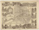
 Mapová sbírka Přírodovědecké fakulty UK v PrazeA plan of the city of Bristol
 -
 Mapová sbírka Přírodovědecké fakulty UK v PrazeA plan of the castle of Chester
 -
 Mapová sbírka Přírodovědecké fakulty UK v PrazeMoscow
 -
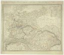
 Mapová sbírka Přírodovědecké fakulty UK v PrazeGermany.
 -
 Mapová sbírka Přírodovědecké fakulty UK v PrazePhilip's Plan of the town and port of Liverpool
 -
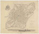
 Mapová sbírka Přírodovědecké fakulty UK v PrazePlan of Dundee
 -
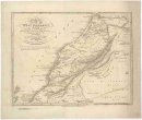 Mapová sbírka Přírodovědecké fakulty UK v PrazeAn accurate map of west Barbary, including Suse & Tafilelt, forming the dominions of the present emperor of Marocco
 -
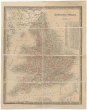 Mapová sbírka Přírodovědecké fakulty UK v PrazeEngland & Wales
 -
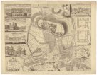
 Mapová sbírka Přírodovědecké fakulty UK v PrazeBowles's new pocket plan of the cities of London and Westminster, with the borough of Southwark
 -
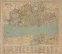
 Mapová sbírka Přírodovědecké fakulty UK v PrazeA new complete & correct map of Southampton and its suburban district
 -
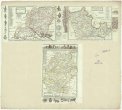
 Mapová sbírka Přírodovědecké fakulty UK v PrazePlan of the roads from Scarbro' Whitby, &c. to Sunderland, Schields, &c. through York, Durham, &c. and of that through Guisbro' Stockton, Castle Eden, &c.
 -
 Mapová sbírka Přírodovědecké fakulty UK v PrazeDevonshire
 -
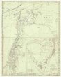
 Mapová sbírka Přírodovědecké fakulty UK v PrazeMap of the Oregon districts and the adjacent country
 -
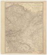
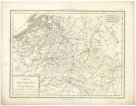
 Mapová sbírka Přírodovědecké fakulty UK v PrazeCarte générale d'Allemagne.
 -
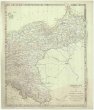
 Mapová sbírka Přírodovědecké fakulty UK v PrazeCarte de la monarchie prussienne, a l'orient du Weser.
 -
 Mapová sbírka Přírodovědecké fakulty UK v PrazePossessions du roi de Prusse a l'ouest du Weser.
 -
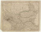
 Mapová sbírka Přírodovědecké fakulty UK v PrazeCarte de la Haute Saxe et de la Lusace.
 -
 Mapová sbírka Přírodovědecké fakulty UK v PrazeCarte des cercles du Haut et Bas Rhin.
 -
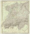
 Mapová sbírka Přírodovědecké fakulty UK v PrazeCercle de Baviere.
 -
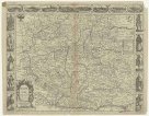
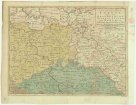
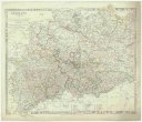
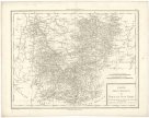
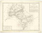
 Mapová sbírka Přírodovědecké fakulty UK v PrazeCarte de la Boheme, et de la Moravie.
 -
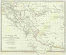
 Mapová sbírka Přírodovědecké fakulty UK v PrazeEtats orientaux de l'empereur a partir de la Baviere et de la Boheme.
 -
 Mapová sbírka Přírodovědecké fakulty UK v PrazeCarte du comté de Tirol et des possessions de la maison d'Autriche dans le cercle de Souabe.
 -
 Mapová sbírka Přírodovědecké fakulty UK v PrazeCarte des Pays-Bas Autrichiens.
 -
 Mapová sbírka Přírodovědecké fakulty UK v PrazeThe east Indies with the roads
 -
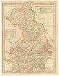 Mapová sbírka Přírodovědecké fakulty UK v PrazeCambridgeshire
 -
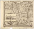
 Mapová sbírka Přírodovědecké fakulty UK v PrazePlan of the city & castle of Chester
 -
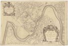
 Mapová sbírka Přírodovědecké fakulty UK v PrazePlan du jardin & vuë des maisons de Chiswick sur la Tamise a deux lieves de Londres
 -
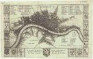
 Mapová sbírka Přírodovědecké fakulty UK v PrazeA new mapp of the city of London
 -
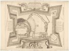
 Mapová sbírka Přírodovědecké fakulty UK v PrazeAn exact plan of the gardens and park at Wilton the seat of Henry Earl of Pembroke
 -
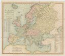 Mapová sbírka Přírodovědecké fakulty UK v PrazeEurope divided according to the general treaty signed 1.st june 1815 in Congress at Vienna
 -
 Mapová sbírka Přírodovědecké fakulty UK v PrazeA sketch of the roads within fourteen miles of Tunbridge Wells
 -
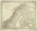
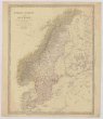 Mapová sbírka Přírodovědecké fakulty UK v PrazeSweden, Norway and Denmark
 -
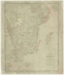
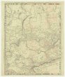
 Mapová sbírka Přírodovědecké fakulty UK v PrazePhilips' large scale military map of the seat of war of the Natal frontier
 -
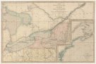 Mapová sbírka Přírodovědecké fakulty UK v PrazeA MAP EXHIBITING THE FRONTIERS of CANADA and the UNITED STATES
 -
 Mapová sbírka Přírodovědecké fakulty UK v PrazeSpitzbergen