-
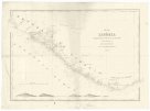 Mapová sbírka Přírodovědecké fakulty UK v PrazeMap of Liberia
 -
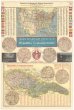 Mapová sbírka Přírodovědecké fakulty UK v PrazeMapa Spojených států S. A. s označením českých osad a Republiky československé
 -
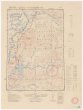
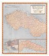 Mapová sbírka Přírodovědecké fakulty UK v PrazeMapa Československa
 -
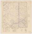
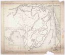
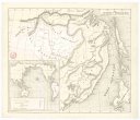 Mapová sbírka Přírodovědecké fakulty UK v PrazeKarta Amurského a Přímorského kraje
 -
 Mapová sbírka Přírodovědecké fakulty UK v PrazeTopographical drawings
 -
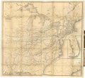
 Mapová sbírka Přírodovědecké fakulty UK v PrazeThe United States and adjoining portions of Canada and Mexico
 -
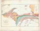
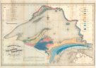 Mapová sbírka Přírodovědecké fakulty UK v PrazeGeological Map of the Lake Superior land district in the state of Michigan
 -
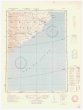
 Mapová sbírka Přírodovědecké fakulty UK v PrazeHonto
 -
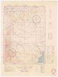
 Mapová sbírka Přírodovědecké fakulty UK v PrazeOl'ga
 -
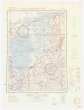
 Mapová sbírka Přírodovědecké fakulty UK v PrazeSamarka.
 -
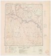
 Mapová sbírka Přírodovědecké fakulty UK v PrazeSpassk-Dal'niy
 -
 Mapová sbírka Přírodovědecké fakulty UK v PrazeTaldan
 -
 Mapová sbírka Přírodovědecké fakulty UK v PrazeVyazemskaya
 -
 Mapová sbírka Přírodovědecké fakulty UK v PrazeZavitaya
 -
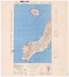 Mapová sbírka Přírodovědecké fakulty UK v PrazeParamushiru
 -
 Mapová sbírka Přírodovědecké fakulty UK v PrazeMap of the railroads in the United States
 -
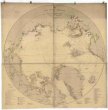 Mapová sbírka Přírodovědecké fakulty UK v PrazeThe Arctic Regions.
 -
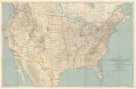
Mapová sbírka Přírodovědecké fakulty UK v PrazeMap of the United States and Territories
-
 Mapová sbírka Přírodovědecké fakulty UK v PrazeKarta Amurského a Přímorského kraje
 -
 Mapová sbírka Přírodovědecké fakulty UK v PrazeAtlas accompanying reports on Upper Peninsula 1839-1873
 -
 Mapová sbírka Přírodovědecké fakulty UK v PrazeAtlas accompanying volume II. geological survey of Wisconsin
 -
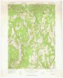 Mapová sbírka Přírodovědecké fakulty UK v PrazeColrain quadrangle
 -
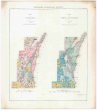
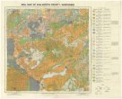 Mapová sbírka Přírodovědecké fakulty UK v PrazeSoil map of Walworth County, Wisconsin
 -
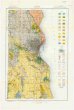 Mapová sbírka Přírodovědecké fakulty UK v PrazeSoil map Wisconsin