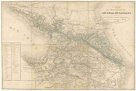
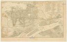
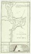
Geognostische Karte des Libanon und Antilibanon in Sirien
description
Barev. 52 x 55 cm Měřítko [ca 1:290 000]. 10,4 cm =4 deutsche Meilen. 9,6 cm = 15 geographische Meilen (035°12´20" v.d.--036°55´49" v.d./034°39´20" s.š.--033°02´10" s.š.)
- institution
- Mapová sbírka Přírodovědecké fakulty UK v Praze
- subcollection
- Mapová sbírka
- type
- Mapy
- subject author
- Rufsegger, Josef
- date of issue
- 1842
- document publisher
- E. Schweizerbart'sche Buchhandlung
- language
- Němčina
- origin
- Německo, Stuttgart
- material
- Papír
- inventory number
- 1289559
next subjects
-
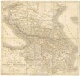
 Mapová sbírka Přírodovědecké fakulty UK v PrazeCarte des posessions Russes au-dela du Caucase
 -
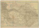
 Mapová sbírka Přírodovědecké fakulty UK v PrazeCharte générale du pays entre les mers Noire et Caspienne
 -
 Mapová sbírka Přírodovědecké fakulty UK v PrazeCentral-Asien
 -
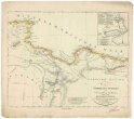
 Mapová sbírka Přírodovědecké fakulty UK v PrazeReise in Kordufan und Nubien
 -
 Mapová sbírka Přírodovědecké fakulty UK v PrazePlan von Kahira
 -
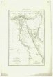 Mapová sbírka Přírodovědecké fakulty UK v PrazeCarte de l'Egypte
 -
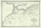 Mapová sbírka Přírodovědecké fakulty UK v PrazeDas Kaiserreich Fez und Marokko
 -
 Mapová sbírka Přírodovědecké fakulty UK v PrazeKarte der Nordküste Afrika's
 -
 Mapová sbírka Přírodovědecké fakulty UK v PrazePlan de la partie inférieure de Ouadi Mousa