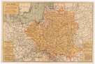
Oesterreichisch-russisch-türkischer Kriegsatlas
description
Mědiryt, ručně kolor., podlep. plátnem 157 x 188 cm, slož. na 79 x 49 cm Měřítko [ca 1:1 500 000]. 7,7 cm = 20 Gemeine polnische Meilen. 7,8 cm = 15 Deutsche oder geographische Meilen. 7,7 cm = 75 Römische oder italiaenische Meilen von 56 Klaftern = 86 Griechische Meilen von 7 Stadien od. beiloeufig 660 Klaftern = 13 Gemeine ungrische Meilen = 104 Russische Werste 7 auf eine geographische Meile = 21 1/2 Agahs od. türkische Meilen, 4 griechischen Meilen gleich. (009°05´08" v.d.--046°21´44" v.d./052°14´28" s.š.--034°31´28" s.š.)
- institution
- Mapová sbírka Přírodovědecké fakulty UK v Praze
- subcollection
- Mapová sbírka
- type
- Mapy
- dating
- 18. století, 1751-1800
- date of issue
- 1788
- document publisher
- F. A. Schraembl
- language
- Němčina
- origin
- Rakousko, [Wien]
- material
- Papír
- literature
- IKAR
- inventory number
- 001290133
next subjects
-
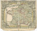
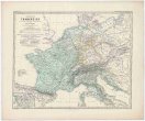 Mapová sbírka Přírodovědecké fakulty UK v PrazeKaiserthum Frankreich
 -
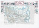 Mapová sbírka Přírodovědecké fakulty UK v PrazeKarta Rossiiskoj Imperii
 -
 Mapová sbírka Přírodovědecké fakulty UK v PrazeKarte für die in den Jahren 1827-1831 beobachteten Werthe der Declination
 -
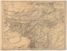 Mapová sbírka Přírodovědecké fakulty UK v PrazeKarte von Afghanistan
 -
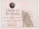 Mapová sbírka Přírodovědecké fakulty UK v PrazeKarte von Alt Preussen
 -
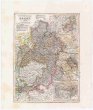 Mapová sbírka Přírodovědecké fakulty UK v PrazeKurfürstenthum HESSEN
 -
 Mapová sbírka Přírodovědecké fakulty UK v PrazeLe royaume de France et les conquetes de Louis de Grand
 -
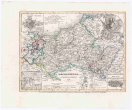 Mapová sbírka Přírodovědecké fakulty UK v PrazeMECKLENBURG
 -
 Mapová sbírka Přírodovědecké fakulty UK v PrazeMapa Polski