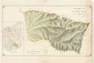
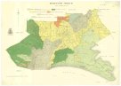
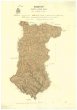
Topographical map of Hills district between Adelaide & the Bremer Ranges
description
Barev. 69 x 51 cm na listu 77 x 59 cm Měřítko [ca 1:130 000]. 7,7 cm = 6 miles (138°16´26" v.d.--139°06´51" v.d./034°32´17" j.š.--035°22´14" j.š.)
- institution
- Mapová sbírka Přírodovědecké fakulty UK v Praze
- subcollection
- Mapová sbírka
- type
- Mapy
- subject author
- Jižní Austrálie
- date of issue
- 1890-1910
- document publisher
- Surveyor General's Office
- language
- Angličtina
- origin
- Austrálie a oceánie, Adelaide
- material
- Papír
- original owner
- Razítko Státní sbírka mapová Republiky československé
- inventory number
- 1614682
next subjects
-
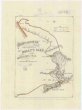
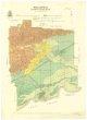
 Mapová sbírka Přírodovědecké fakulty UK v PrazeTopographical plan of the National Park Hd. of Adelaide
 -
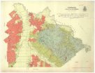
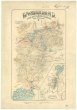
 Mapová sbírka Přírodovědecké fakulty UK v PrazeTourists sketch map
 -
 Mapová sbírka Přírodovědecké fakulty UK v PrazeTowong
 -
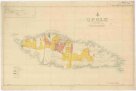 Mapová sbírka Přírodovědecké fakulty UK v PrazeUpolu
 -
 Mapová sbírka Přírodovědecké fakulty UK v PrazeWaratah North
 -
 Mapová sbírka Přírodovědecké fakulty UK v PrazeWelshpool
 -
 Mapová sbírka Přírodovědecké fakulty UK v PrazeWide Bay
 -
 Mapová sbírka Přírodovědecké fakulty UK v PrazeWonderland, the Hot Lakes region
 -
 Mapová sbírka Přírodovědecké fakulty UK v PrazeWonyip