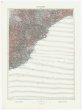
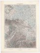
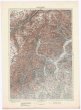
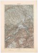
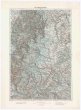
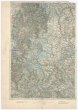
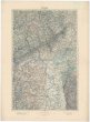
Strassen und Gebirgs-Karte zur Reise von Wien durch Oesterreich, Salzburg, Kärnthen, Steyermark und Tyrol bis München
description
Kolor., podlepena plátnem 49,5 x 70 cm na listu 74 x 54 cm, složeno na 18 x 12,5 cm v papírových deskách 19 x 13 cm Měřítko 1:576 000. 10,7 cm = 8 oesterreichische Post-Meilen (011°02´48" v.d.--016°41´17" v.d./048°36´13" s.š.--046°24´54" s.š.)
- institution
- Mapová sbírka Přírodovědecké fakulty UK v Praze
- subcollection
- Mapová sbírka
- type
- Mapy
- alternate name
- Guide du voyageur dans les Alpes en Autriche, Salzbourg, Styrie, Carinthie et Tyrol
- subject author
- Biller, Dominik;Artaria & Co.
- date of issue
- 1845-1860
- document publisher
- Artaria & Co.
- language
- Němčina
- origin
- Rakousko, Wien
- material
- Papír
- original owner
- Razítko Státní sbírka mapová.
- inventory number
- 1360989
similar subjects
-
 Mapová sbírka Přírodovědecké fakulty UK v Praze26°44° Savona
 -
 Mapová sbírka Přírodovědecké fakulty UK v Praze26°44° Savona
 -
 Mapová sbírka Přírodovědecké fakulty UK v Praze26°45° Alessandria
 -
 Mapová sbírka Přírodovědecké fakulty UK v Praze26°46° Varese
 -
 Mapová sbírka Přírodovědecké fakulty UK v Praze26°47° Zürich
 -
 Mapová sbírka Přírodovědecké fakulty UK v Praze26°48° Schaffhausen
 -
 Mapová sbírka Přírodovědecké fakulty UK v Praze26°48° Schaffhausen
 -
 Mapová sbírka Přírodovědecké fakulty UK v Praze26°49° Karlsruhe
 -
 Mapová sbírka Přírodovědecké fakulty UK v Praze26°50° Mainz