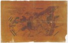
Mappa genaralis topographico-ecclesiastico-ethnographico-statistica regni Hungariae
description
Litografie, barev., podlepena plátnem 85 x 136 cm, 1 list 46 36,5 cm, složeno na 23 x 19 cm v papírovém pouzdře 24 x 19,5 cm + Měřítko [ca 1:702 500]. 15,8 cm = 15 geograph. Meilen. 15,8 cm = 13,3 ungarische [Meilen]. 13,8 cm = 14,67 oesterreich. [Meilen]. 13,8 cm = 103,4 russische Werste (015°58´26" v.d.--023°05´35" v.d./048°40´09" s.š.--045°37´45" s.š.)
- institution
- Mapová sbírka Přírodovědecké fakulty UK v Praze
- subcollection
- Mapová sbírka
- type
- Mapy
- alternate name
- Karte von Ungarn
- subject author
- Aszalay de Szendrö, József;František
- date of issue
- 1830-1840
- language
- Latina
- origin
- Evropa, Vindobonae
- material
- Papír
- original owner
- Státní sbírka mapová Republiky československé
- inventory number
- 1359205
similar subjects
-
![Die Maßen der Lagers bey Dobra Woda [unweit] Münchengratz](/data/cache/media/95/11878137-136x110-1707323355.jpg) Mapová sbírka Přírodovědecké fakulty UK v PrazeDie Maßen der Lagers bey Dobra Woda [unweit] Münchengratz
Mapová sbírka Přírodovědecké fakulty UK v PrazeDie Maßen der Lagers bey Dobra Woda [unweit] Münchengratz -
 Mapová sbírka Přírodovědecké fakulty UK v PrazeAccurater GrundRiss der Stadt und Vestung Ollmütz
 -
![Lager der k. k. Armée, im Jahr 1759 im Fruh-Jahr, bey Marcklissa in Schleßien anaus gearbeitet. Da der König aus Preußen das Lager bey [Schmotseihfen] besetzte](/data/cache/media/c6/11878165-136x110-1707323356.jpg) Mapová sbírka Přírodovědecké fakulty UK v PrazeLager der k. k. Armée, im Jahr 1759 im Fruh-Jahr, bey Marcklissa in Schleßien anaus gearbeitet. Da der König aus Preußen das Lager bey [Schmotseihfen] besetzte
Mapová sbírka Přírodovědecké fakulty UK v PrazeLager der k. k. Armée, im Jahr 1759 im Fruh-Jahr, bey Marcklissa in Schleßien anaus gearbeitet. Da der König aus Preußen das Lager bey [Schmotseihfen] besetzte -
![[Vojenské postavení mezi Prosekem a Kbely]](/data/cache/media/90/11878179-136x110-1707323356.jpg) Mapová sbírka Přírodovědecké fakulty UK v Praze[Vojenské postavení mezi Prosekem a Kbely]
Mapová sbírka Přírodovědecké fakulty UK v Praze[Vojenské postavení mezi Prosekem a Kbely] -
 Mapová sbírka Přírodovědecké fakulty UK v PrazeNeue Himelsbelchreibung
 -
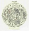 Mapová sbírka Přírodovědecké fakulty UK v PrazeMondkarte
 -
 Mapová sbírka Přírodovědecké fakulty UK v PrazeDas Georama auf Elisäischen Feldern zu Paris
 -
 Mapová sbírka Přírodovědecké fakulty UK v PrazeStereographischer Entwurf des Gestirnten Himmels
 -
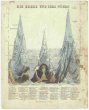 Mapová sbírka Přírodovědecké fakulty UK v PrazeDie Berge und ihre Höhen