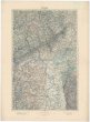
Karte von Danzig, Elbing, und Marienburg oder erstes Blat von Westpreussen.
description
Mědiryt, kolor. 44 x 54,5 cm na listu 48 x 58 cm Měřítko [ca 1:137 000]. 5,4 cm = 1 geographische oder deutsche Meile (018°13´34" v.d.--019°45´12" v.d./054°27´03" s.š.--053°51´14" s.š.)
- institution
- Mapová sbírka Přírodovědecké fakulty UK v Praze
- subcollection
- Mapová sbírka
- type
- Mapy
- date of issue
- 1789
- document publisher
- F.A. Schraembl
- language
- Němčina
- origin
- Rakousko, Wien
- material
- Papír
- inventory number
- 001367853
similar subjects
-
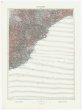 Mapová sbírka Přírodovědecké fakulty UK v Praze26°44° Savona
 -
 Mapová sbírka Přírodovědecké fakulty UK v Praze26°44° Savona
 -
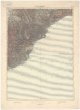
 Mapová sbírka Přírodovědecké fakulty UK v Praze26°45° Alessandria
 -
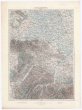
 Mapová sbírka Přírodovědecké fakulty UK v Praze26°46° Varese
 -
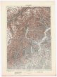
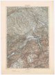 Mapová sbírka Přírodovědecké fakulty UK v Praze26°47° Zürich
 -
 Mapová sbírka Přírodovědecké fakulty UK v Praze26°48° Schaffhausen
 -
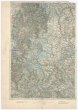 Mapová sbírka Přírodovědecké fakulty UK v Praze26°48° Schaffhausen
 -
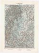
 Mapová sbírka Přírodovědecké fakulty UK v Praze26°49° Karlsruhe
 -
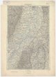
 Mapová sbírka Přírodovědecké fakulty UK v Praze26°50° Mainz