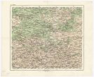
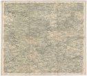
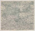
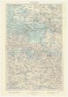
Neueste allgemeine Postkarte von Europa in welcher sämtliche Postrouten aller europäischen Staaten
description
Kolor., podlepena plátnem 72 x 80 cm, sestavená 144 x 160 cm, slož. na 37 x 53 cm Měřítko [ca 1:2 200 000]. 10,3 cm = 30 deutsche oder geographische Meilen. 9 cm = 120 englische Meilen. 9,7 cm =100 irländische Meilen. 10,4 cm = 30 daenische Meilen. 9,8 = 20 schwedische Meilen. 9,6 cm = 200 russische Werste. 10 cm = 40 polnische Meilen. 9,1 cm = 100 türkische Berri. 8,7 cm = 20 ungarische Meilen. 9,5 cm = 30 böhmische Meilen. 10,5 cm = 30 preussische Meilen. 8,9 cm = 100 italiaenische Meilen. 9 cm = 40 franzoesische Meilen. 10,5 cm = 50 spanische Meilen. 9,3 cm = 30 portugiesische Meilen (013°40´32" z.d.--031°12´04" v.d./059°50´41" s.š.--034°48´49" s.š.)
- institution
- Mapová sbírka Přírodovědecké fakulty UK v Praze
- subcollection
- Mapová sbírka
- type
- Mapy
- alternate name
- Nouvelle Carte des routes des postes dans les différens états de l'Europe :
- date of issue
- 1807
- document publisher
- Tranquillo Mollo
- language
- Němčina
- origin
- Rakousko, Wien
- material
- Papír
- original owner
- K. k. Post- u. Telegrafenamt Königstadtl.
- inventory number
- 1293658
similar subjects
-
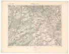
 Mapová sbírka Přírodovědecké fakulty UK v PrazeŽitomir
 -
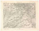
 Mapová sbírka Přírodovědecké fakulty UK v PrazeŽitomir
 -
 Mapová sbírka Přírodovědecké fakulty UK v PrazeŽitomir
 -
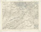
 Mapová sbírka Přírodovědecké fakulty UK v PrazeŻytomir
 -
 Mapová sbírka Přírodovědecké fakulty UK v PrazeŻytomir
 -
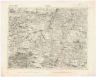
 Mapová sbírka Přírodovědecké fakulty UK v PrazeŻydaczów und Stryj
 -
 Mapová sbírka Přírodovědecké fakulty UK v PrazeŻydaczów und Stryj
 -
 Mapová sbírka Přírodovědecké fakulty UK v PrazeŻydaczów und Stryj
 -
 Mapová sbírka Přírodovědecké fakulty UK v PrazeŻołkiew