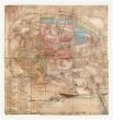
Historisch-geographisch-statistisch-gefaellsaemtliche Karte vom Königreiche Böhmen
description
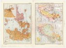
Kolor. 26,5 x 36,5 cm na listu 52,5 x 66 cm Měřítko [ca 1:1 040 000]. 5 cm = 7 geograph. Meilen = 7 post Meilen (012°00´29" v.d.--016°49´32" v.d./051°05´23" s.š.--048°30´33" s.š.)
- institution
- Mapová sbírka Přírodovědecké fakulty UK v Praze
- subcollection
- Mapová sbírka
- type
- Mapy
- subject author
- Bastien, Joseph;Mayregg, Cajetan von
- date of issue
- 1831
- document publisher
- Cajetan von Mayregg
- language
- Němčina
- origin
- Hlavní město Praha, Prag
- material
- Papír
- inventory number
- 1425861
similar subjects
-
 Mapová sbírka Přírodovědecké fakulty UK v PrazePlán Starého a Židovského města pražského
 -
 Mapová sbírka Přírodovědecké fakulty UK v PrazeTři historické mapy k dějinám českým
 -
 Mapová sbírka Přírodovědecké fakulty UK v PrazeRegni Bohemiae mappa historica
 -
 Mapová sbírka Přírodovědecké fakulty UK v PrazePlán Starého Města Pražského z roku 1729
 -
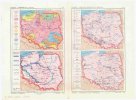 Mapová sbírka Přírodovědecké fakulty UK v PrazePoliticko-hospodářský atlas světa
 -
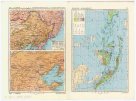 Mapová sbírka Přírodovědecké fakulty UK v PrazePoliticko-hospodářský atlas světa
 -
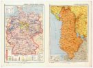 Mapová sbírka Přírodovědecké fakulty UK v PrazePoliticko-hospodářský atlas světa
 -
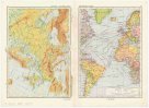 Mapová sbírka Přírodovědecké fakulty UK v PrazePoliticko-hospodářský atlas světa
 -
 Mapová sbírka Přírodovědecké fakulty UK v PrazePoliticko-hospodářský atlas světa