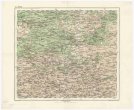
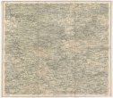
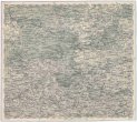
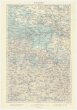
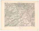
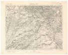
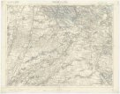
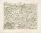
Karte des Königreiches Böhmen
description
Litografie, barev., podlepena plátnem 64 x 74,5 cm na listu 70,5 x 84 cm, složena na 18 x 12 cm v papírovém pouzdře 18 x 13 cm Měřítko [ca 1:438 000]. 13,5 cm = 8 deutsche od. geografische Meilen. 13,7 cm = 8 österreichische Postmeilen. 13,3 cm = 60 Kilometer (011°55´12" v.d.--016°54´48" v.d./051°07´51" s.š.--048°30´59" s.š.)
- institution
- Mapová sbírka Přírodovědecké fakulty UK v Praze
- subcollection
- Mapová sbírka
- type
- Mapy
- alternate name
- Karte von Böhmen
- subject author
- Mück, Anton
- date of issue
- 1886
- document publisher
- Artaria
- language
- Němčina
- origin
- Rakousko, In Wien
- material
- Papír
- original owner
- Státní sbírka mapová Republiky československé
- inventory number
- 1360552
similar subjects
-
 Mapová sbírka Přírodovědecké fakulty UK v PrazeŽitomir
 -
 Mapová sbírka Přírodovědecké fakulty UK v PrazeŽitomir
 -
 Mapová sbírka Přírodovědecké fakulty UK v PrazeŽitomir
 -
 Mapová sbírka Přírodovědecké fakulty UK v PrazeŻytomir
 -
 Mapová sbírka Přírodovědecké fakulty UK v PrazeŻytomir
 -
 Mapová sbírka Přírodovědecké fakulty UK v PrazeŻydaczów und Stryj
 -
 Mapová sbírka Přírodovědecké fakulty UK v PrazeŻydaczów und Stryj
 -
 Mapová sbírka Přírodovědecké fakulty UK v PrazeŻydaczów und Stryj
 -
 Mapová sbírka Přírodovědecké fakulty UK v PrazeŻołkiew