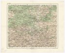
Karte von Afrika
description
Litografie, barev. 34 x 48 cm na listu 46 x 59 cm Měřítko [ca 1:22 400 000]. 4,3 cm = 130 geographische, deutsche Meilen 15=1 Grad = 600 geographische Meilen 60=1 Grad = 200 See Meilen 20=1 Grad (039°22´30" z.d.--074°10´46" v.d./039°38´22" s.š.--036°35´52" j.š.)
- institution
- Mapová sbírka Přírodovědecké fakulty UK v Praze
- subcollection
- Mapová sbírka
- type
- Mapy
- date of issue
- 1868
- document publisher
- Artaria
- language
- Němčina
- origin
- Rakousko, Wien
- material
- Papír
- original owner
- Razítko Museum regni Bohemiae
- inventory number
- 1393276
similar subjects
-
 Mapová sbírka Přírodovědecké fakulty UK v PrazeŽitomir
 -
 Mapová sbírka Přírodovědecké fakulty UK v PrazeŽitomir
 -
 Mapová sbírka Přírodovědecké fakulty UK v PrazeŽitomir
 -
 Mapová sbírka Přírodovědecké fakulty UK v PrazeŻytomir
 -
 Mapová sbírka Přírodovědecké fakulty UK v PrazeŻytomir
 -
 Mapová sbírka Přírodovědecké fakulty UK v PrazeŻydaczów und Stryj
 -
 Mapová sbírka Přírodovědecké fakulty UK v PrazeŻydaczów und Stryj
 -
 Mapová sbírka Přírodovědecké fakulty UK v PrazeŻydaczów und Stryj
 -
 Mapová sbírka Přírodovědecké fakulty UK v PrazeŻołkiew