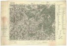
Charte von der europaeischen Türkey mit den anliegenden Republiken der Sieben Inseln u. Ragusa
description
Kolor. 41 x 31 cm na listu 51 x 41 cm Měřítko [ca 1:4 200 000]. 5,4 cm = 30 geographische Meilen = 2°des Aequators. 5,4 cm = 44 türkische Agash, wovon 22 = 1° des Aequators oder 15 deutsche Meilen (015°13´37" v.d.--031°09´26" v.d./049°04´00" s.š.--034°39´04" s.š.)
- institution
- Mapová sbírka Přírodovědecké fakulty UK v Praze
- subcollection
- Mapová sbírka
- type
- Mapy
- subject author
- Kipferling, Karl Joseph
- date of issue
- 1820
- document publisher
- J. Riedl's Kunsthandlung
- language
- Němčina
- origin
- Rakousko, Wien
- material
- Papír
- inventory number
- 001358500
similar subjects
-
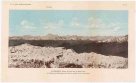 Mapová sbírka Přírodovědecké fakulty UK v PrazeGaurisankar (Mount Everest) und die Nepal-Alpen vom Südsporn des Kinchinjunga (in der Nähe des Chumbab La) aus Osten gesehen
 -
 Mapová sbírka Přírodovědecké fakulty UK v PrazeAllgemeiner grosser Schrämblischer Atlass
 -
 Mapová sbírka Přírodovědecké fakulty UK v PrazeAllgemeiner GROSSER ATLASS
 -
 Mapová sbírka Přírodovědecké fakulty UK v PrazePříbram
 -
 Mapová sbírka Přírodovědecké fakulty UK v PrazePlzeň
 -
 Mapová sbírka Přírodovědecké fakulty UK v PrazeReims (Châlons s. Marne)
 -
 Mapová sbírka Přírodovědecké fakulty UK v PrazeBrünn
 -
![[Ioannina]](/data/cache/media/e2/12268330-136x110-1707323888.jpg) Mapová sbírka Přírodovědecké fakulty UK v Praze[Ioannina]
Mapová sbírka Přírodovědecké fakulty UK v Praze[Ioannina] -
![[Lefkada]](/data/cache/media/38/12268315-136x110-1707323888.jpg) Mapová sbírka Přírodovědecké fakulty UK v Praze[Lefkada]
Mapová sbírka Přírodovědecké fakulty UK v Praze[Lefkada]