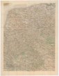
Uibersichts Karte der Eisen-Bahn-Route, zwischen Wien und Bochnia, nebst den Flügel-Bahnen
description
Barev. litografie 22,6 x 35 cm na listu 26,3 x 39,6 cm Měřítko [ca 1:1 150 000]. 19,3 cm = 30 deutsche Meilen 15 auf einen Grad (016°02´24" v.d.--020°22´07" v.d./050°11´02" s.š.--048°05´33" s.š.)
- institution
- Mapová sbírka Přírodovědecké fakulty UK v Praze
- subcollection
- Mapová sbírka
- type
- Mapy
- date of issue
- 1850
- document publisher
- H. Engel
- language
- Němčina
- origin
- Rakousko, Wien
- material
- Papír
- original owner
- Státní sbírka mapová Republiky československé
- inventory number
- 1298726
similar subjects
-
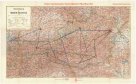 Mapová sbírka Přírodovědecké fakulty UK v PrazeÜbersichtskarte der Republik Österreich
 -
![Die zentralen Balkanländer zwischen Adria u[nd] Pontus](/data/cache/media/b9/12155296-136x110-1707323222.jpg) Mapová sbírka Přírodovědecké fakulty UK v PrazeDie zentralen Balkanländer zwischen Adria u[nd] Pontus
Mapová sbírka Přírodovědecké fakulty UK v PrazeDie zentralen Balkanländer zwischen Adria u[nd] Pontus -
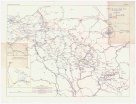 Mapová sbírka Přírodovědecké fakulty UK v PrazeOesterreich-Ungarns letzter Krieg
 -
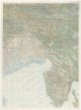
![Neue Generalkarte des österr[eichisch]-ungar[isch]-russischen Kriegsschauplatzes Bessarabien](/data/cache/media/7e/12236937-136x110-1707323223.jpg) Mapová sbírka Přírodovědecké fakulty UK v PrazeNeue Generalkarte des österr[eichisch]-ungar[isch]-russischen Kriegsschauplatzes Bessarabien
Mapová sbírka Přírodovědecké fakulty UK v PrazeNeue Generalkarte des österr[eichisch]-ungar[isch]-russischen Kriegsschauplatzes Bessarabien -
 Mapová sbírka Přírodovědecké fakulty UK v PrazeÜbersichtskarte des russischen Kriegsschauplatzes
 -
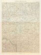
 Mapová sbírka Přírodovědecké fakulty UK v PrazeNeue Generalkarte des südwestlichen Kriegsschauplatzes
 -
 Mapová sbírka Přírodovědecké fakulty UK v PrazeNeue Generalkarte des deutsch-französischen Kriegsschauplatzes
 -
 Mapová sbírka Přírodovědecké fakulty UK v PrazeG Freytags Karte von Nordost-Frankreich und Belgien
 -
 Mapová sbírka Přírodovědecké fakulty UK v PrazeNeue Generalkarte des südwestlichen Kriegsschauplatzes.