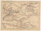
Geographisch-historische Karte des Kriegsschauplatzes in Europa in den Jahren 1828 u. 1829
description
Čb. 42 x 37 cm na listu 53 x 44 cm Měřítko neuvedeno (023°14´49" v.d.--029°23´57" v.d./045°47´53" s.š.--040°48´04" s.š.)
- institution
- Mapová sbírka Přírodovědecké fakulty UK v Praze
- subcollection
- Mapová sbírka
- type
- Mapy
- subject author
- Ehrenkreutz, Br. von;Deberghes
- date of issue
- 1835
- document publisher
- C. V. Sommerlatt
- language
- Němčina
- origin
- Německo, [Aachen?]
- material
- Papír
- inventory number
- 001290262
similar subjects
-
 Mapová sbírka Přírodovědecké fakulty UK v PrazeŠumperk
 -
 Mapová sbírka Přírodovědecké fakulty UK v PrazeŁódź
 -
 Mapová sbírka Přírodovědecké fakulty UK v PrazeŁódź
 -
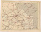
 Mapová sbírka Přírodovědecké fakulty UK v PrazeÜbrige Länder der ehemaligen Österreich-Ung. Monarchie
 -
 Mapová sbírka Přírodovědecké fakulty UK v PrazeÜbrige Länder der ehemaligen Österreich-Ung. Monarchie
 -
 Mapová sbírka Přírodovědecké fakulty UK v PrazeÜbrige Länder der ehemaligen Österreich-Ung. Monarchie
 -
 Mapová sbírka Přírodovědecké fakulty UK v PrazeÜbrige Länder der ehemaligen Österreich-Ung. Monarchie
 -
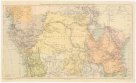 Mapová sbírka Přírodovědecké fakulty UK v PrazeÜbersichtskarte zum Zuge der Emin Pascha - Entsatzexpedition quer durch Afrika
 -
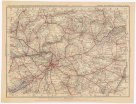
 Mapová sbírka Přírodovědecké fakulty UK v PrazeÜbersichtskarte von Mitteleuropa 1:300 000